
Google Maps has been a trusted direction source for years, but its depths are more than just point A to point B directions. Hidden in its design are secret features that can transform the way individuals navigate, plan, and even recall their trips.
This article reveals five secret features of Google Maps, exposing tricks that make it a navigation powerhouse from a mere directions app.
Street View offers more than a current snapshot of a location; it’s a virtual time machine. By clicking the clock icon in the top-left corner of a Street View image on the desktop version, users can scroll through archived photos dating back years. A city street might reveal how it looked before a skyscraper rose, or a rural road could show seasonal changes over time.
This feature, often overlooked, lets history buffs and curious minds peel back layers of the past without leaving their screens. It’s like stepping into a photo album of the world, updated with every Google car’s pass.
Connectivity fades in remote areas, but Google Maps doesn’t have to. Hikers scaling mountains or drivers crossing spotty rural zones find this a lifesaver. The maps include roads, landmarks, and even some business details, all stored on the device. It’s a quiet secret that turns a phone into a reliable guide, with no bars required.
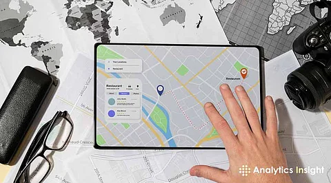
Google Maps hides a personal organizer in plain sight: the ‘Saved’ tab. Beyond pinning favourite spots, users can create custom lists, like ‘Weekend Getaways’ or ‘Best Coffee Shops’, and add places with notes or tags. A quick tap on the three-dot menu next to any location offers the option to categorize it.
Sharing lists with friends or keeping them private makes travelling planning or following haunts a snap. Restaurants, parks, or out-of-the-way roadside attractions are catalogued, turning haphazard bookmarks into a personalized travel diary at the touch of a finger.
Pedestrian signs get a high-tech upgrade with Live View, an augmented reality mode that displays digital signals superimposed on the real environment. Activating it requires starting navigation, and then selecting the ‘Live View’ button near the map. A phone’s camera springs to life, overlaying arrows and signs onto the street ahead.
No more squinting at tiny blue dots or guessing which alley to take, visual markers guide the way. It’s especially handy in dense cities where buildings blur together, offering a sci-fi spin on finding the next turn. The battery drain runs high, but the clarity pays off.
Need to know how far one spot lies from another without driving? Google Maps has a measuring tool tucked away. On the desktop, right-clicking a starting point and choosing ‘Measure Distance,’ then clicking elsewhere, draws a line with the exact mileage or kilometres displayed.
Mobile users drop a pin, swipe up for details, and hit ‘Measure Distance’ to plot points. Runners mapping a route, planners eyeing a hike, or anyone curious about a straight-line span can use this trick. It’s a subtle feature that turns the app into a digital ruler for real-world spaces.
Google Maps proves itself more than a navigation staple, it’s a Swiss Army knife of hidden tools. Street View's time-travelling eye opens windows to yesterday, and offline maps stay on course past the grid. Custom lists civilize the untamedness of favourite spots, Live View blends reality and direction, and the distance measurer gratifies practical curiosity.
These are features, so frequently hidden beneath the app's familiar surface, that rewards a little excavation. As daily routines or epic adventures are played out in 2025, Google Maps contains secrets that enrich every journey, making it wiser and more surprising. What other treasures can still be concealed in its code?