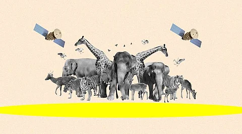

Wildlife conservation has always been critical to preserving our planet's rich biodiversity. With technological advancements, satellite-based monitoring systems have emerged as powerful tools for tracking and studying animal populations across vast and remote areas. These systems offer unprecedented insights into various species' movements, behaviors, and habitats. Integrating machine learning (ML) techniques with satellite monitoring has revolutionized wildlife research and conservation efforts in recent years. This article delves into the exciting potential of ML in enhancing satellite wildlife monitoring, highlighting a groundbreaking study that showcases its capabilities.
Traditional wildlife monitoring methods, such as ground surveys and radio telemetry, have inherent limitations, particularly when studying elusive or migratory species. Satellite-based systems provide a game-changing solution by offering a comprehensive and global perspective on animal behavior. These systems utilize satellite imagery, remote sensing technologies, and geolocation data to monitor wildlife populations over vast geographic areas.
Machine learning, a branch of artificial intelligence, equips computers to learn from and analyze large datasets without explicit programming. ML algorithms can recognize patterns, make predictions, and accurately identify anomalies. When integrated with satellite-based monitoring, ML algorithms can process massive amounts of satellite data to extract valuable insights and automate tasks that would otherwise be time-consuming and labor-intensive.
In a recent study published in the journal "Nature Ecology & Evolution," researchers from leading conservation organizations and academic institutions collaborated to investigate the potential of ML in satellite wildlife monitoring. The study focused on the endangered African elephant population in the Tarangire National Park in Tanzania. By combining satellite imagery, GPS tracking data, and ML algorithms, the researchers aimed to assess the efficacy of ML in accurately identifying and tracking individual elephants.
The researchers employed a two-step approach. Firstly, they used high-resolution satellite imagery to detect elephants and extract features such as size, shape, and texture. ML algorithms were then trained to recognize these features and classify the detected objects as elephants. This initial step laid the foundation for accurate identification.
Secondly, the researchers utilized GPS tracking data from a subset of elephants in the study area. By combining the identified satellite images with the GPS data, ML algorithms were trained to associate specific elephant features with individual animals. This enabled the researchers to create a comprehensive and automated real-time system for tracking individual elephants.
The results of the study were remarkable. The ML algorithms achieved an accuracy rate of over 90% in correctly identifying individual elephants from satellite images. Furthermore, the automated tracking system demonstrated the ability to monitor elephant movements continuously, providing valuable data on migration patterns, habitat utilization, and potential human-wildlife conflicts.
The successful integration of ML with satellite monitoring in this study opens up a world of possibilities for wildlife research and conservation. By automating the identification and tracking processes, researchers can efficiently monitor populations on a large scale, including species that were previously challenging to study. This technology can revolutionize our understanding of wildlife behavior and inform evidence-based conservation strategies.
Moreover, the ML-powered satellite monitoring system can provide real-time alerts about the presence of endangered species in protected areas, aiding in anti-poaching efforts. Early detection of poaching activities can allow for rapid response interventions, ensuring the protection of vulnerable species.
As with any technological advancement, further research and development are needed to refine and expand the capabilities of ML in satellite wildlife monitoring. Fine-tuning ML algorithms, integrating additional data sources, and exploring other remote sensing technologies will enhance the accuracy and scope of this approach. Collaborations between conservation organizations, technology companies, and research institutions are crucial to harnessing the full potential of ML for wildlife conservation.
Satellite wildlife monitoring and machine learning represent a significant leap forward in our ability to understand and protect the world's endangered species. The groundbreaking study discussed in this article highlights the immense potential of ML in accurately identifying and tracking individual animals.
Join our WhatsApp Channel to get the latest news, exclusives and videos on WhatsApp
_____________
Disclaimer: Analytics Insight does not provide financial advice or guidance on cryptocurrencies and stocks. Also note that the cryptocurrencies mentioned/listed on the website could potentially be scams, i.e. designed to induce you to invest financial resources that may be lost forever and not be recoverable once investments are made. This article is provided for informational purposes and does not constitute investment advice. You are responsible for conducting your own research (DYOR) before making any investments. Read more about the financial risks involved here.